Houston Metro Area & Counties that in Consist of Through the
Houston Metro Area
Houston Metro Area

The City of Houston has a long history starting in 1837. Known as the Bayou City, Space City, Clutch City, and now the third largest metropolitan city in the country. Houston is still growing and bringing more jobs and industry each year. Great news because we have an amazing rich city of diverse people from all around the world. Learn more with the link below. The City of Houston is vast in the size of land and the metropolitan Houston area is more expansive when considering it hits 8 counties, 3 loops and over 6 million people as of 2022 according to Macrotrends.net. Macrotrends.net states about 100,000 people move to Houston area each year. The city has grown a lot over the last 185 plus years, and become the most diverse city in the country. It is home of the first dome stadium, the Eight Wonder of the World (Astrodome) and only city with 4 indoor arenas.
610 Loop
Houston Metro Area
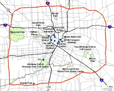
As the city has grown from it's original grounds of Downtown Houston, city officials in 1931 began to talk about a highway system that made life easier to get around this expanding city. Talks began to pick up steam again around WWII, when it was purposed as a way to transport troops from one end of the city to the other. At first there was only the North Loop, designated as the "Defense Loop". Construction was delayed until the 1950's when the West and South portion were added, then in the East portion being added in 1960 completely THE LOOP. The loop is 38 miles which goes all the way around Houston. Downtown is of course inside the Loop, but that has a separate tab. Inside the Loop is sectioned off into the following: Central Inner Loop, Northwest Inner Loop, East End, and South Loop.
Beltway 8

This City is so large it actually has two more loops that go around all of Houston. Beltway 8, got it's name in 1969, way before it became a toll road. Construction of the toll road began in the early 1980's, and is considered our second loop that runs 88 miles around. This part of the city is broken up into 8 sections: North Houston, Northwest, Northeast, South, Southeast, Southwest, East and West. Here you'll find cities within the city or small towns or villages like on the West side of town.
Grand Parkway aka Hwy 99
Grand Parkway aka Hwy 99

Construction first began in 1994, and is still ongoing as you can see from the picture above. When completed 99 will connected the majority of the Houston Metro area together crossing over, Fort Bend County, Montgomery County, Liberty County, Chambers County, Galveston County, and Brazoria County. The Grand Parkway when completed it will be the longest beltway in the United States.
Harris County
Grand Parkway aka Hwy 99
Fort Bend County
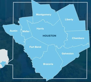
Harris County is the largest county in the state of Texas which connects to 7 other counties that include the Houston Metro Area. Clink the link below to learn more.
Fort Bend County
Grand Parkway aka Hwy 99
Fort Bend County
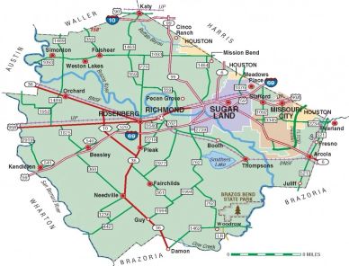
Fort Bend County on the southwest side of the Houston Metro area and has several great towns or cities within it. Sugar Land has been rated one of the best cities to live in the country. Other cities and towns within Fort Bend are Missouri City, Stafford, Fulshear, Richmond, Rosenberg, Weston Lakes, Needville, Fresno, and a small portion of Houston Metro Area.
Montgomery County
Montgomery County
Montgomery County
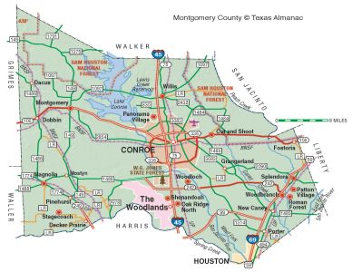
Montgomery County to the North of Houston, has one of the best towns in the country with the Woodlands, but also includes Conroe, Magnolia, Oak Ridge North, Shenandoah, Porter, New Caney, Splendora, Willis & Cut and Shoot. There are some small portions of Houston within Montgomery County, as well as portions in Houston's ETJ.
Galveston County
Montgomery County
Montgomery County
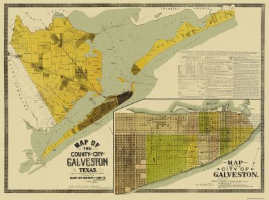
Galveston was established in 1816 by the French. In the 19th century Galveston was one of the largest ports in the country. Galveston over the last decade has had many new developments of residential and commercial business hitting the island. Galveston County contains several nice towns within it including: Friendswood, Kemah, La Marque, Dickinson, San Leon, Bacliff, League City, Santa Fe, Texas City and the city of Galveston.
Brazoria County
Montgomery County
Brazoria County

Brazoria County is south of Houston off highway 288, extending to Fort Bend County to the west and Galveston County to the east. Brazoria is much like Galveston and Waller, as they are cities and counties within their boundaries. Other cities/towns include Pearland, Angleton, Alvin, Clute, West Columbia, Sweeny, Iowa Colony, Manvel, Lake Jackson and Surfside.
Waller County
Chambers County
Brazoria County

Waller County has been growing in population over the last couple of decades. Only 44 miles from downtown Houston taking highway 290, Waller has become a place for those that want to stay close to Houston, but not too close. Unlike Fort Bend and Montgomery Counties, Waller County does not extend into any portion of the city of Houston. Towns in Waller are Katy, Brookshire, Prairie View, Patton Village and Hempstead.
Liberty County
Chambers County
Chambers County

Liberty County is a bit further away to our northeast, but as the city grows more outer rings begin to connect to Houston. With 99 being completed more and more now Liberty has become a part of an outer ring of Houston. There are plenty of people that come into Houston from Cleveland and Dayton for work, as they drive home for peace away from the big city.
Chambers County
Chambers County
Chambers County

Chambers County is connected to Houston by way of Baytown which a small portion is within the county, and Harris County. Chambers county has a few other small towns/cities where their residents commute to Houston for work. Closest besides Baytown, are Mont Belvieu, Double Bayou, Smith Point, Monroe City, and Anahuac.
DOWNTOWN Houston
Downtown Houston
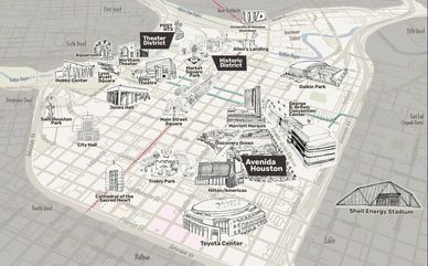
This amazing city of course has an outstanding Downtown District which consist of 10 different districts:
Theater District
Historic District
Avendia District
Shopping District
Civic District
Skyline District
Southern District
Warehouse District
East End District
World Series Ball Park District.
Theater District
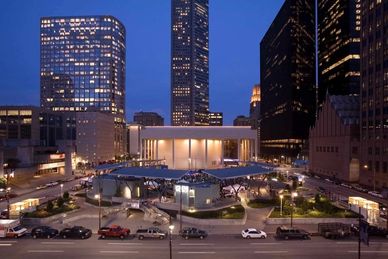
Our Theater District is one of the country's best, that rivals that of New York City. I believe ours is best over NYC. Houston’s spans 17 blocks in the northwest part of downtown. It includes 9 different venues of entertainment along with several restaurants and bars for a great evening out on the town. Houston has everything from live music, plays, opera, sports, with the following venues to visit:
Revention Music Center
Alley Theatre
Hobby Center for the Performing Arts
Jones Hall
Bayou Place
Wortham Theater Center
Sundance Theatre
Historic District
Historic District
Houston's Historic District is the oldest part of the city. Still there are some homes from the early 1900's, while skyscrapers are only blocks away. Walking distance to everything downtown. Learn more about the downtown area with the link below.
Avendia District
Shopping District
Historic District
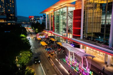
Avenida District is where the George R. Brown Convention Center is located, Discovery Green Park which is across the street from the Toyota Center, home of the Houston Rockets. Recently there has been an addition of some of Houston's favorite restaurants like: Pappasitos, Saltgrass, Grotto, Pappadeaux, and the Rustic with live music. And there is of courses one of Houston's Hall of Famer Biggio's Sports Bar in walking distance to Minute Maid Park. Check out all there is to do on the link below.
Shopping District
Shopping District
Shopping District
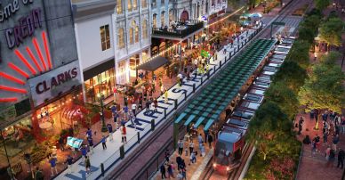
The Shopping District is the area where the Market Square now sits, with some of the oldest buildings surrounding the area filled with bars, restaurants, and retails shops on the surface as well as underground in the tunnels. On a Spring or Summer's day you may find live music in the square, as well as many other events celebrating the many cultures of the city. See what all there is to do on the website.
Civic District
Shopping District
Shopping District
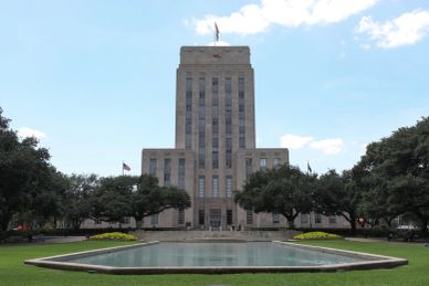
Civic District is the home for City Hall when it was moved from the Market Square in 1939. Houston Public Library is located next to City Hall, a stones throw from the only outdoor museum that includes 9 historic homes from 1823 to 1905. This area is home for the annual forth of July fireworks. Learn more with a click of the website.
Skyline District
Warehouse District
Southern District
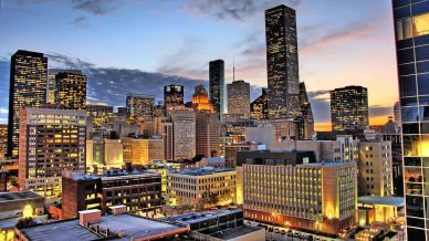
The Skyline District is our beautiful skyscrapers. These tall high rises are home to some of the nation's top companies in the world, and each year attract more with the additions of the mix-use buildings, and amazing structures. As I mentioned in the Shopping District there is a tunnel system under our downtown that connects many of these skyscrapers with restaurants, and shops for workers on the go. Find out more about the Skyline District with the website below.
Southern District
Warehouse District
Southern District
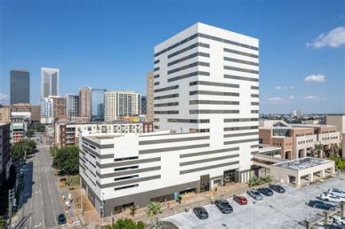
Southern District is an exciting area of downtown with several new residential properties opening soon or already open. This area is home to St. Joseph Medical Center, Houston's first hospital, founded in 1887. Learn a little more on the link below.
Warehouse District
Warehouse District
East End District or EADO
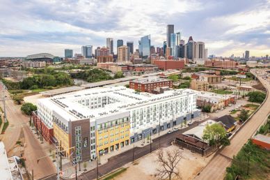
This City is so large it actually has two more loops that go around all of Houston. Beltway 8, got it's name in 1969, way before it became a toll road. Construction of the toll road began in the early 1980's, and is considered our second loop that runs 88 miles around. This part of the city is broken up into 8 sections: North Houston, Northwest, Northeast, South, Southeast, Southwest, East and West. Here you'll find cities within the city or small towns or villages like on the West side of town.
East End District or EADO
World Series Ball Park District
East End District or EADO
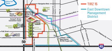
East End or EADO as it is now known to those in the know. EADO is home Shell Energy Stadium and Houston Dynamo along with a lot bars with live music, entertainment venues, restaurants, apartments and walking distance to everything. There is a mix of new apartments, residential warehouses, town-homes, and old homes. Check out the link below to learn more.
World Series Ball Park District
World Series Ball Park District
World Series Ball Park District
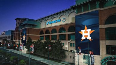
Ball Park District is home of the World Series Champion Astros. When first built in the Old Union Station area, the downtown area was going through transition and now has several upscale restaurants, sports bars, condos, luxury apartments, hotels surrounding Minute Maid Park.
SOUTH INNER LOOP-MEDICAL CENTER-MUSEUM DISTRICT-UNIVERSITY
Museum District
Herman Park Conservancy
Museum District
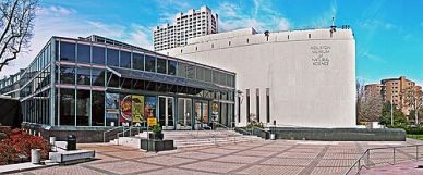
The Houston Museum District includes more than 20 different museums, that are dedicated in promoting arts, science, history and culture. The district is a focal point of the area as it is minutes from our 3 largest universities, Medical Center, Herman Park and Houston Zoo. On Thursday many of the museums offer free entry, check out their website for all they have to offer.
Medical Center
Herman Park Conservancy
Museum District
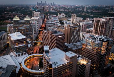
The Houston Medical Center is the top place for medicine in the world. The center piece of the medical center is MD Anderson Cancer Center and contains 54 medicine institutions, more than 20 hospitals, 8 specialty institutions, along with 8 academic and research institutions, 4 medical schools, 7 nursing schools, 2 pharmacy schools and a dental school. Thousands of people come from around the world each year to have their medical needs met. Visit the website below to learn more.
Herman Park Conservancy
Herman Park Conservancy
Herman Park Conservancy
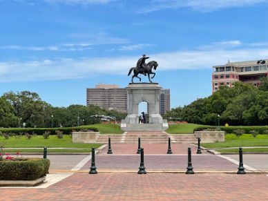
Hermann Park, donated by George Hermann to the City of Houston in 1914, consists of 445 acres in the heart of Houston. The Park serves over six million annual visitors, most of whom come from the Park’s surrounding neighborhoods, which represent a diverse cross-section of the City’s population. Beyond that majority, visitors come from across Houston as well as from outside the city limits. Herman Park Convancy- Founded in 1992 as Friends of Hermann Park, Hermann Park Conservancy is a nonprofit citizens’ organization dedicated to the stewardship and improvement of Hermann Park – today and for generations to come. Through a public-private partnership with the Houston Parks and Recreation Department, the Conservancy has raised over $125 million for improvement projects in Hermann Park, one of Houston’s most historic and popular greenspaces.
Houston Zoo
West University Place or West U
Herman Park Conservancy
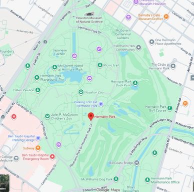
The Houston Zoo has been around for over 100 years, opening in 1922. It is committed to being a leader in the global effort to save animals in the wild. They are home to over 4,300 permanent residents (our animals). They provide the highest standard in animal care. Every time you visit the Zoo, you're helping them save animals in the wild. They collaborating with 52 organizations in 17 countries around the world to save wildlife. Throughout the year they offer special events, like Zoo Lights, during the holiday season, and benefits for members. Check out their website.
West University Place or West U
West University Place or West U
West University Place or West U
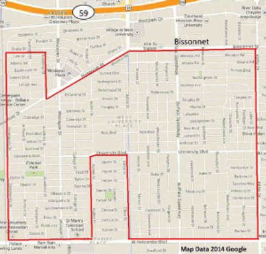
West University Place or West U to cut it short got it's name because of how close the community is to Rice University. West U is yet another great small city within Houston's boundaries Hooper. West U today is still one of the best urban communities inside Houston. Learn more with the link below.
Southside Place
West University Place or West U
West University Place or West U
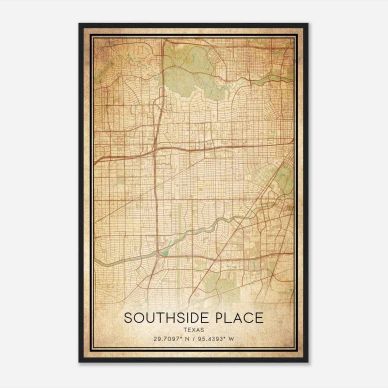
Southside Place is obviously not the largest area of town yet it is a very affluent area of Houston, south of West University along Bellaire Boulevard west of Edloe St. Even though a very small area the community is in the top 15 in wealth for the State of Texas.
University Area
University Area
University Area
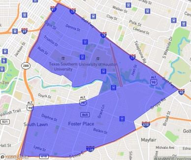
University Area consist of Third Ward, and the MacGregor Park areas that wraps around Riverside Terrace. Even though Houston has more than a dozen colleges and universities, the two largest are in this area, University of Houston and Texas Southern University. Located right outside of downtown Houston, off I-45 South and 288 the location has been prime for redevelopment. With the expansion of U of H, much of the area has brought a younger population and gentrification of the area with more mixed use development, town-homes on many of the vacant lots, as well as old homes being torn down and replaced with 2 to 4 stories stand alone
Third Ward
University Area
University Area

Third Ward is one of the oldest parts of the city, being one of the first political subdivisions or "Ward" created in 1936. This area is a part of the revitalization of inner city of Houston. Over the last two decades the area has taken on new life with much of the area being redeveloped with new homes, and mixed use buildings. Check out homes for sale in the area.
MacGregor Place
University Area
Riverside Terrace
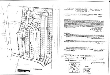
MacGregor Place is an older subdivisions near the U of H and TSU campus’ that were developed after the end of World War II, near MacGregor Park. The two subdivisions together make up this area and with the revitalization of the University area this is one of the part of Houston that is becoming more desirable to live in inside the city limits. The proximity to Downtown and Medical Center make it a great place for younger people to be able to afford city living.
Riverside Terrace
Riverside Terrace
Riverside Terrace

Riverside Terrace is an affluent neighborhood off 288 wedged into the University Area. There are over 20 sections of Riverside Terrace, and many of the lots individually restricted. The first section was platted in 1924. Much of this area is being gentrified since the turn of the century. The lots that had restriction expire, have gone through a redevelopment with town-homes. Many of the lots are large and have beautiful mansions, and estate homes.
Braeswood Place
Riverside Terrace
Knollwood Village
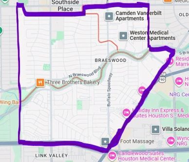
Braeswood Place is a combination of several subdivisions like the MacGregor area. Ayrshire, Braes Heights, Braes Oaks, Braes Manor, Braes Terrace, Emerald Forest, and Southern Oaks make up this area of Houston right inside the loop south of West U and Southside Place. In the 1990’s the creation of the Stella Link Redevelopment Association (SLRA) began to make big changes to the community that had gone down in the 80’s because of crime and drugs. The SLRA put together a master plan working with the city to improve area by purchased rundown apartment complexes and commercial buildings as well as putting in place new restrictions to protect property values. Then Tropical Storm Allison in June of 2001 hit and flooded over 20% of the area. This lead for a quicker movement away from the 1940 and 50’s homes and the building of two-story Colonial, Tudor and Stucco homes with increased size.
Knollwood Village
Riverside Terrace
Knollwood Village
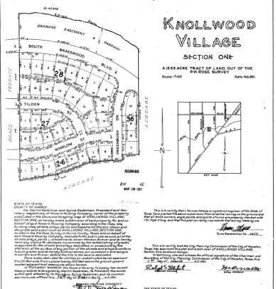
Knollwood Village is located on the southwest side inside the 610 Loop, and has ten sections which were developed in the 1950’s and 60’s. At the time of building it was considered the outskirts of Houston before the 610 Loop. When the original homes were built they were between 1700-2400 square feet. Today the neighborhood has gone through a transition to nicer larger homes, much like Braeswood Place and neighboring inner city town of Bellaire. The majority of the original homes that still exist have been renovated with current kitchen updates and fresh bathroom design.
CENTRAL INNER LOOP
Midtown
The Montrose
The Montrose
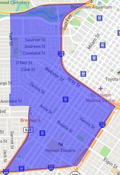
Midtown is centrally located in Houston west of downtown and east of the Montrose. At the turn of the century the area began to go through a revitalization. Bars, and nightlife began to bring more and more people to want to live closer to the downtown with addition of Minute Maid Park and Toyota Center. Commercial development began to build more multi-family luxury complexes, as we as more single family homes.
The Montrose
The Montrose
The Montrose
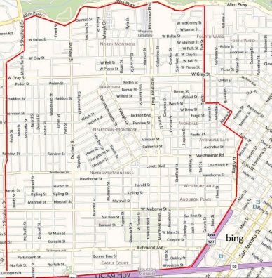
The Montrose District came about around 1911. Much of the area is not deed restricted which allows for a variety of architectures from cottages, town-homes, restored mansion, contemporary condos, high rises, duplex's and fourplex's. It is located between River Oaks and Mid-Town Districts within the Hyde Park, Montrose and 70+ subdivisions and additions that make up this eccentric and diverse community. The Montrose is one of the most unique parts of Houston with lots of restaurants, bars, eclectic stores and shops.
River Oaks
The Montrose
River Oaks
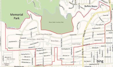
River Oaks is one of the most luxurious neighborhoods in Houston, as well as one of the wealthiest in the country. It was developed in the 1920's, by Will and Michael Hogg sons of the former Governor of the State of Texas. and was the national standard for community planning. In 2011, River Oaks was recognized as one of the top 10 most expensive housing developments in the country.
Afton Oaks
Highland Village
River Oaks
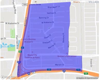
Afton Oaks is located just opposite of the Galleria area on the west side of the inner 610 loop. Afton Oaks is an upscale deed restricted part of Houston with near by shopping centers and restaurants in the Highland Village.
Highland Village
Highland Village
Highland Village
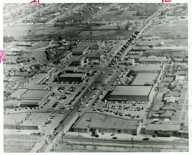
Highland Village established in 1957, in one of Houston's most fashionable neighborhoods and has some exclusive shopping venues, as well as some of the great retail spots and restaurants to have drinks and good food. Visit the website to learn more.
Upper Kirby
Highland Village
Highland Village
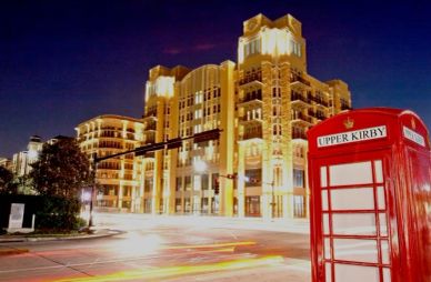
Upper Kirby is an upscale part of Houston which spans from Buffalo Speedway on north side of 59 to Westheimer and Shepherd, and from Kirby to Bissonnet, and Edloe. This area is a network of great historic additions and subdivisions filled with mix use developments, including some of the original homes, to and newly built large traditional style houses and high profile retail shops, and trendy boutiques and things to do, day and night.
Greenway Plaza
Greenway Plaza
Greenway Plaza
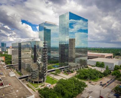
Greenway Plaza, was first envisioned in the 1960's by Kenneth L. Schnitzer. The entire office complex is spans over 52 acres, and 4.4 million square feet of office space. It is also home of Lakewood Church, has plenty of residential spaces as well as restaurants and bars.
NORTHWEST INNER LOOP-GREATER HEIGHTS
Greater Heights
Woodland Heights
Greater Heights
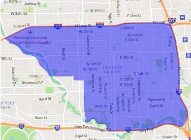
The Greater Heights area is a fairly large parcel of land which spans between I-45 North and the West Loop. From I-10 to the North Loop. The Greater Heights area includes other additions like Houston Heights, Clark Pines, Heights Addition, West Heights, Sunset Heights, Woodland Heights, Studes, Norhill, and Shady Acres are non-restricted, with exception to those placed on particular blocks and those by ordinance of the City Houston. Over the last 3 decades the Greater Heights area has gone through an amazing transformation and revitalization, with Woodland Heights and Norhill getting a designation of Historic on many of those streets. There has also been more updating of the quaint cottages, as well as many being torn down and replaced with large New Orleans style townhomes, and 2-4 story townhomes, with roof top decks. Over the last 5 years with prohibition being lifted on the sale of alcohol in Houston Heights, the area has welcomed more restaurants and bars. Click below to see what the Heights Chamber of Commerce provides.
Houston Heights
Woodland Heights
Greater Heights
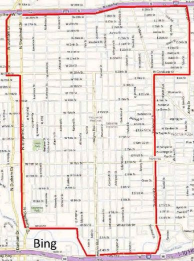
Houston Heights gets its name because the area was 23 feet higher in elevation than most of the existing city at the time of development in 1891 by Oscar Martin Carter. Houston Heights was one of Texas' first planned communities and once it's own municipality, until 1919 when annexed by the City of Houston. The Greater Heights area has had its share of bars and restaurants all over it, with the exception of Houston Heights platted subdivision that did not allow the sale of alcohol until 2019. In 2018 the city placed it up for vote, and the citizens said yes. Within months the residents saw more and more bars pop up on 19th and 20th Streets, Shepherd, Durham, and Yale. With this it has brought more and more young professionals to visit and move to the area. This has meant more development of luxury apartment complexes, shopping, additional mixed use buildings, and the first two story H.E.B. This all allowing growth in the neighborhood as well as providing for an increase value of real estate, since the Heights is only minutes away from the Galleria, Downtown and Memorial Park.
Woodland Heights
Woodland Heights
Woodland Heights
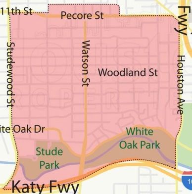
Woodland Heights is one of the oldest additions to the City of Houston, being first platted by William A. Wilson in 1907. Many of the original homes that are still standing in the area are part of Historic Houston. This part of the Heights is between Studewood on the west and I-45 on the east, south of Pecore and north of I-10. Because of proximity to downtown and scarcity of land in area, the property values are generally highest in this part of the Heights. William A. Wilson was a developer that like to individually restrict his property at the time of conveying to an individual. Ask me what this means.
Studes
Sunset Heights
Woodland Heights
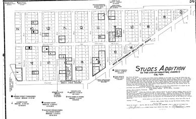
Studes is a small development within the Greater Heights area. Studes has two sections that are individually restricted properties. This means some properties may have restrictive covenants that limit how the property can be used. I've placed a map of Studes which shows many of the lots that have been replatted into another subdivision within Studes Addition.
Norhill
Sunset Heights
Sunset Heights
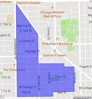
Norhill was developed in 1920 by Will Hogg, of the Hogg Family, who have behind many developments in Houston. The Norhill area consist of East Norhill, North North and Norhill Addition, which was brought about as a working man’s River Oaks, also developed by Will Hogg. This is another historic part of Houston with many of the original bungalow homes are still standing. The bungalows were catalog purchases from Ladies’ Home Journal and Sears Roebuck. The bungalow home seem to be a perfect fit for the area as it came in various styles, from Colonial, Spanish, English, Craftsman, and Hipped, all seem to fit the 50 by 100 foot lots. This is another part of the Greater Heights that is individually restricted. This is something developers look for when buying properties in the Great Heights area.
Sunset Heights
Sunset Heights
Sunset Heights
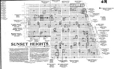
Sunset Heights was established in 1910, by Richard Rodgers of Sunset Heights Realty Co. This area is west of Cortlandt, and east of Airline, south of the North Loop and north of 20th st/W. Cavalcade St. In the early part of the turn of century the area began to gentrify along with much of the Heights area. Resident in the area in 2006 began to see the trend of builders going into parts of the Heights dividing up lots and putting up town-homes. In 2007 the City of Houston agreed to establish a minimum lot size requirement in the area. The minimum lot size requirement allow for property values to steadily increase over the years, especially when the older homes are removed and nicer larger homes are built in their place. View the website to learn more.
Brooke Smith
Cottage Grove
Cottage Grove
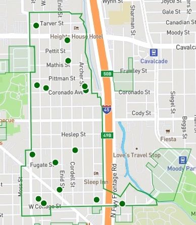
Brooke Smith is another great little addition to the City of Houston founded in 1905 located in the 77009 zip code. It begins north of the Norhill area, and extends a couple blocks north of Cavalcade along the west side of I-45. This area has taken on a slower transition than the areas south. Many of the lots are not deed restricted which is leading many builders to start purchasing older homes in the area and building town-homes of 2-4 stories with a few having roof top decks. With the excellent location this area is transitioning to an area with full size homes as well and town-home and patio home communities near by.
Cottage Grove
Cottage Grove
Cottage Grove
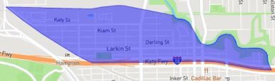
Cottage Grove established in 1910, as one of the first suburbs. The proximity to Memorial Park, Galleria, and Downtown had this area go through a big transformation in the early 2000’s when many of the older homes on large lots began to get knocked down and replaced by multiple town-homes and patio homes on a single lot. The area is also part of historic Heights with an eclectic collection of homes from cottages, town-homes, patio homes and commercial business including a few restaurants and bars within walking distance. See what Cottage Grove has to offer on their website.
Shady Acres
Cottage Grove
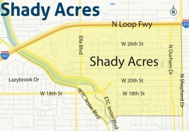
Shady Acres is located on the northwest portion of the Greater Heights area. It's between West TC Jester and North Shepherd, and south of the North Loop and 15th Street. There are parts of 15 streets to 22nd street that are located in Houston Heights, of the map above. Over the last decade the area has gone through a major transformation with the legalization of alcohol in the Heights. Since the prohibition of alcohol sales in the Heights was removed the entire has taken on new life with more bars and restaurants. This area taken over with a younger crowd that enjoy walking over to these recently opened establishments to hangout and have an adult beverage and good meal.
Clark Pines
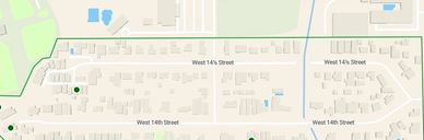
Clark Pines is a picturesque neighborhood nestled in Harris County, Houston, Texas, with the zip code 77008. Known for its tranquil atmosphere and green surroundings, Clark Pines is a hidden gem within the bustling metropolis. The neighborhood's location offers the perfect balance between residential calmness and proximity to the vibrant city life. The area is surrounded by mature trees and lush greenery, creating a serene environment that adds to its charm and appeal. The residences in Clark Pines are a mixture of traditional and contemporary homes, capturing a unique blend of Houston's architectural history and modern aesthetics. The neighborhood's homes are well-maintained and feature beautifully landscaped yards. The community is known for its inclusivity and diversity, with residents ranging from young professionals to retirees. The sense of community is strong in Clark Pines, with neighbors often coming together for block parties and potlucks.
Timbergrove Manor
Timbergrove Manor
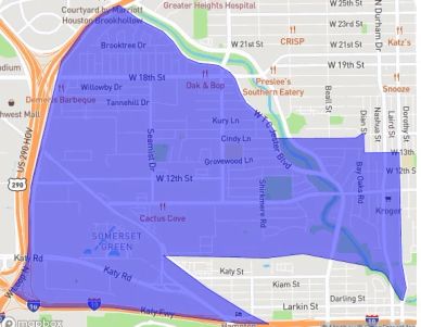
Timbergrove Manor is a subdivision first developed in the 1950’s. This subdivision is one of the nicest and a more traditional subdivision inside the city that we see more of in the suburbs today. Along with Lazybrook they both are inside the northwest portion of the 610 Loop, right outside of the Heights. Located only minutes from Downtown, the Galleria and Memorial Park, this subdivision has plenty of older homes that have been renovated with updated styles as well has new large homes that are priced in the millions. Timbergrove Manor has been able to maintain the values due to it being a deed restricted subdivision.
Lazybrook
Timbergrove Manor
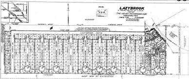
Lazybrook is a neighboring subdivision on the north side of Eighteenth street. Developed around the same time as Timbergrove to the south of 18th, this is also a deed restricted subdivision with many ranch style homes that still remain. This subdivision unlike Timbergrove has not had many of the original homes torn down, and replaced by 3500-4000 square foot homes, like Oak Forest and Garden Oaks on the north side of the 610 Loop. See what is available.
WEST INNER LOOP
Washington Corridor/ Buffalo Heights
Washington Corridor/ Buffalo Heights
Washington Corridor/ Buffalo Heights
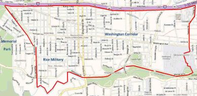
Washington Corridor is a section of Houston that has gone through a revitalization since around 2010 with the addition of several upscale restaurants, bars, luxury apartments, condominiums, and 2, 3, and 4 story town homes up and down Washington Ave from Westscott to Houston Ave and squared off by I-10. The Washington Corridor is just north of Memorial Park and a part of the 6th Ward, Camp Logan and Rice Military Additions. According to he Buffalo Heights District website this district includes Buffalo Bayou Park, Memorial Park, Washington Corridor, Downtown and the Heights. See the link to find out all there is to do in the area.
Rice Military
Washington Corridor/ Buffalo Heights
Washington Corridor/ Buffalo Heights
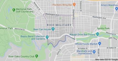
Rice Military is a section of town near Memorial Park that gets in name from a couple of sources. One was by the nearby Camp Logan and original owns of the land Rice Family, as in William Marsh Rice who founded Rice University. In the early 1990's the area began to attract young professionals to be closer to entertainment, bars, restaurants, and Memorial Park.
Memorial Park
Washington Corridor/ Buffalo Heights
Memorial Park
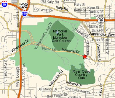
Memorial Park is the largest park in the state of Texas, and one of the largest in the country. It is larger than Central Park in New York. Much of the land where the park sits was sold by the Hogg family to the city to honor the memory of the soldiers in WWI. Over the last two decades the park has gone through a redevelopment. The park is filled with everything from golf courses, tennis, swimming, softball fields, polo fields, baseball, bike routes and jogging trails. Everyday Houstonians take advantage of all the activities. Check out the Memorial Park Conservancy website to find out more.
East Inner Loop
East End Revitalization
East End Revitalization
East End Revitalization
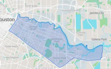
East End Revitalization area of town is a part of EADO together with Magnolia Park, Second Ward and Pecan Park. When the baseball stadium was added to downtown it extended on the other side of highway 59/69, which later brought the addition of Shell Energy Stadium home of the Houston Dynamo. The next thing that came was the bars with live music, entertainment venues, restaurants, apartments in walking distance. This area has plenty of mixed use buildings as well as new apartments, residential warehouses, town-homes, and old homes.
Magnolia Park
East End Revitalization
East End Revitalization
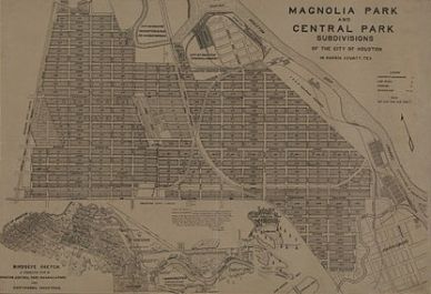
Magnolia Park is a part of the revitalization of the east end. This area was first populated in the early part of the 20th century, around 1913. Because of proximity to downtown this area has gone through a transition with addition of town-homes, and more restaurants and bars.
Second Ward
East End Revitalization
Second Ward
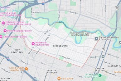
Second Ward is one of the oldest neighborhoods in the city, established in 1840. It is located south of I-10 on the east side of I-45. It is a neighborhood that is taking on new life and undergoing a transition as the proximity to downtown is making it a place for younger adults to find a place to call home.
Pecan Park
Second Ward
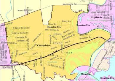
Pecan Park is a large neighborhood that consist of over 30 small additions/subdivisions, with Pecan Park begin the largest in the area, giving its name. The area was once a pecan orchard, going back to the late 1800's, and was developed by Magnolia Park Land Company in 1926. This area also has been brought back to life with the resurgence of Houston's Downtown.
Denver Harbor

Denver Harbor area was first settle in 1891. The area consist of approximately 885 acres, and was once 4 separate platted subdivisions; Denver, Harbor, Harbordale and Liberty Heights, now the area is known as Denver Harbor. The City of Houston annexed the area in 1929. It is located north of the ship channel and along the industrial area of Clinton Drive.
Eastwood

Eastwood lots were first placed up for sale in 1912, and was one of the first master planned subdivision in Houston by William A. Wilson, that developed much of the city in the early twentieth century.
Lawndale-Wayside

Lawndale/Wayside is a collection of neighborhoods which still reflect the area’s origins as a prestigious east side neighborhood. At that time, the municipal Wortham Golf Center was the City’s first country club, what is now the Houston Country Club (established in 1908). The adjacent heavily wooded Country Club and Idylwood neighbor hoods have remained attractive. The areas of Forest Hill and Mason Park are shady, middle class havens with curving streets and large lots. The presence of wooded preserves such as the large Forest Park Cemetery, Villa De Matel convent, Mason Park and Wortham Golf Center have helped to maintain the area's beauty. The entire neighborhood is within the Greater East End Management District.
Houston County Club

Houston Country Club founded in 1908 by William M. Rice, Jr., also the founded of Rice University. It first began as a 9 hole course that was built on 45 acres, leased from the aforementioned Rice University. It was then purchased and developed on 152 acres with 18 hole course on the southeast part of Houston.
Mason Park
Mason Park
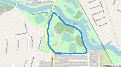
Mason Park created in 1928 as a suburban destination as it was an amazing 5 miles away from downtown. It was originally only a 32 acre tract of land until an additional 70 acres were donated in 1930 by Dora Porter Mason, widow of John Thomas Mason, who the park is now named after. Mason Park is one of the few parks that is connected with MacGregor Park, Memorial Park, Woodland Park, and Sam Houston’s Park by the bayous that travel through the city. The park is back by East Lawndale Civic Association which has much of the credit on the continued development of the park.
NORTHEAST INNER LOOP
Fifth Ward
Kashmere Gardens
Kashmere Gardens
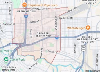
Fifth Ward is another really old addition to Houston, established 1866, 2 miles from downtown. It was settled by freedmen after the Civil Warn and nicknamed the Nickel. It is on Buffalo Bayou to the south, and White Oak Bayou to the west. It is a neighborhood that is rich in history and has new growth here in the 21st century. Check out what you can find.
Kashmere Gardens
Kashmere Gardens
Kashmere Gardens

Kashmere Gardens is located within the far northeast portion inside the loop. It is known as industrial area and rail part of town. It took a huge hit with hurricane Harvey and going through a transition. It is one of the few parts of Houston inside the loop that could be ready for revitalization.
Lindale Park
Kashmere Gardens
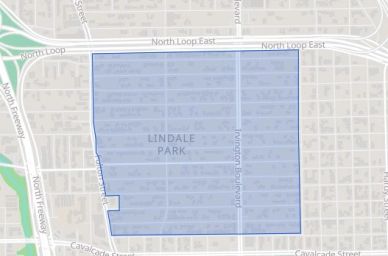
Lindale Park establish in 1937, on the northeast side of downtown, near Lindale Park Golf Course, which was replaced with housing after World War II. Lindale Park is a culturally diverse part of Houston. This part of Houston began to transition in the late 1990’s and has been enjoying a revitalization because of proximity to downtown, and the Woodlands.
Ryon Addition

Ryon, is a neighborhood that combines modern living and historical charm. This community has a rich history developed in 1868. On the north side of downtown Houston, the area has taken on new life at the end of the 20thcentury and continued strong with young professionals, families and retirees, making up this unique vibrancy neighborhood. View what is available in this great neighborhood.
NORTHWEST HOUSTON
Garden Oaks
Jersey Village
Garden Oaks
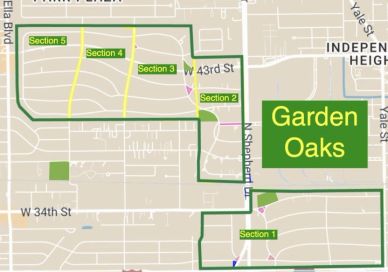
Garden Oaks was established in 1937, and between Yale Blvd and Ella Blvd north of the 610 Loop, and east of Oak Forest. Garden Oaks first sections were large lots, some over a 1/4 of an acre. Much of the older homes have been replaced when the neighborhood began to transition at the beginning of the 21th century. This community is only minutes from downtown, Galleria and Memorial Park, along with award winning schools, plenty of parks, places to eat and drink.
Oak Forest
Jersey Village
Garden Oaks
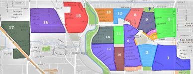
Established in 1947, Oak Forest is one of the largest communities in the Houston city limits. Oak Forest in on the north side of the 610 Loop, beginning around Ella on the east and bordered by on the west by the bayou. Over the last decade the older sections of the neighborhood have been transitioning from the original small homes to much larger homes that are selling for over a million dollars. The community is filled with parks, good schools, and lots of restaurants and bars within minutes.
Jersey Village
Jersey Village
Jersey Village
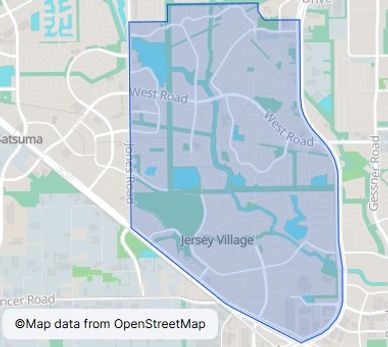
Jersey Village was a subdivision platted in 1954, and incorporated in 1956. It is located west of Beltway 8 and on the north side of 290, east of Jones and south of Fallbrook. Jersey Village is a small city within the boundaries of the City of Houston, much like Bellaire. It has been able to maintain great schools and quality of life for their residents keep resale values of homes steady. Visit the website below to learn more.
Bridgeland
Cypress aka Cyfair
Jersey Village
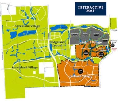
Bridgeland is a master planned community developed by the Howard Hughes Corporation in 2008, north of Katy and south of 290, east of highway 99. This community offers everything for a family. Check out their website for all the details.
Cypress aka Cyfair
Cypress aka Cyfair
Cypress aka Cyfair
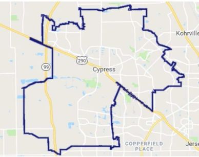
Cyfair or Cypress Fairbanks is one of the largest communities in the ETJ of the city of Houston and includes the city of Jersey Village. Cyfair is also one of the fast growing areas in the country with over 100,000 students in Cyfair ISD. Check out all there is to know about Cypress Fairbank area with a click to the Chambers of Commerce for Cyfair.
Fairfield
Cypress aka Cyfair
Cypress aka Cyfair
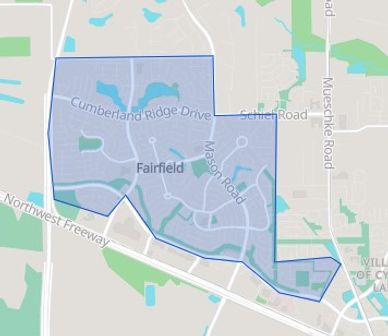
Fairfield was Houston's first master planned community by the Friendswood Development Company in 1988, and is going strong 35 years later. Fairfield has grown what is now Bridgeland community on the south side highway 290. With expansion of 290 Fairfield is an easier drive into town. Click the link to learn more about Friendswood and Fairfield.
Champions
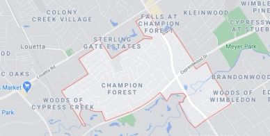
Located in an area of Northwest Houston, Champion Forest is a lovely neighborhood of tree-lined roads. Protected in part by the Champions Forest Homeowners Association, the neighborhood retains is value and character through preservation of its natural bird sanctuary designated in 1980. This beautiful area was built with community in mind.
Beginning as 900 acres of farmland, Don Hand of Greenwood Properties led the effort to develop the area into the now desirable subdivision that exists. Resting around Champion Drive, Champion Forest offers easy access to all manner of restaurants, retail, and outdoor venues making it easy to separate home and work. Beyond Champion Forest, US 249, Interstate 45, and two toll roads provide routes to the Greater Houston area. A twenty-three-mile drive will lead you to downtown Houston where you can experience historical spots, museums, and various sports venues.
Today, homeowners in Champion Forest reside in a variety of homes including traditional-style homes, patio homes, and larger estate homes. Most offer spacious designs with high ceilings and stylish interiors located on large lots draped in mature trees. Residents enjoy community groups which include book clubs, a civic association, gardening, and wine tasting to name a few. The Champion Forest Women’s Club is a service organization offering support to schools and charities in and around the neighborhood.
Enjoy the great outdoors in the surrounding areas of Champion Forest. Spend a day in nature at Cypress Forest Park, Kickerillo-Mischer Preserve, or Mercer Arboretum and Botanical Gardens. Enjoy one of the many nearby parks or visit the Fallen Warriors Memorial honoring Texas men and women who gave their lives to protect our country.
Tomball

Tomball once known as the Peck community renamed in 1907, after Thomas Henry Ball who had a major part in the development of the Port of Houston. Tomball is just north of Waller. Like Waller, Tomball has gone through a growth spurt over the last decade or so. Click the link to see what else there is to be known about Tomball.
SPRING BRANCH
Spring Branch
Spring Valley Village
Spring Valley Village
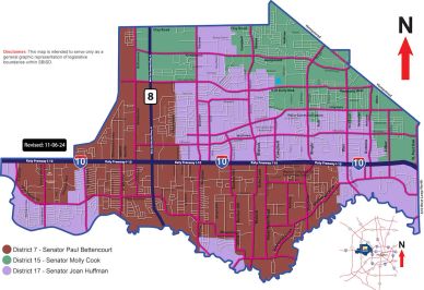
Spring Branch is located west of the 610 Loop on both sides of I-10, and extends to Eldridge between Memorial Drive and Hempstead Highway. This area includes some of the most prominent and wealthiest residential neighborhoods in the State of Texas with the Memorial Villages. Spring Branch also has its own school district. It is also home Memorial City Mall the city's next largest mall, after the Galleria. Besides the wealthy part of the Villages, Spring Branch is very much a blue collar area of Houston with a good mix of people from all around the world.
Spring Valley Village
Spring Valley Village
Spring Valley Village

The first formal step in Spring Valley becoming a city took place on December 14, 1954, when a petition for incorporation signed by 26 residents was presented to Harris County Judge Bob Casey. This requested the incorporation of the Town of Spring Valley under the provisions of Chapter 11, Title 8, Revised Civil Statutes of Texas, 1925. Spring Valley is on the north side of I-10, unlike the others that are on the south side.
Hilshire Village
Spring Valley Village
Hilshire Village
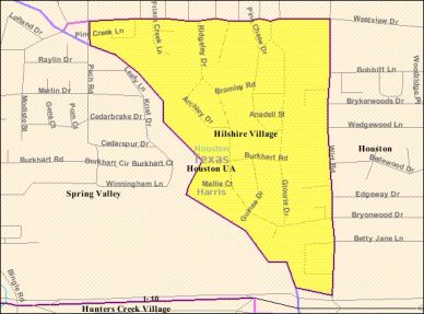
Founded in 1955, the City of Hilshire Village is an urban oasis nestled inside Houston, Texas in Harris County. With an area of about one-third of a square mile, the community is the smallest of six clustered, incorporated municipalities known as the Memorial Villages. Hilshire Village is a zoned municipality with a population of 811 according to the 2022 U.S. Census and comprised of approximately 304 residences, small businesses and churches.
Hedwig Village
Hunters Creek Village
Hilshire Village
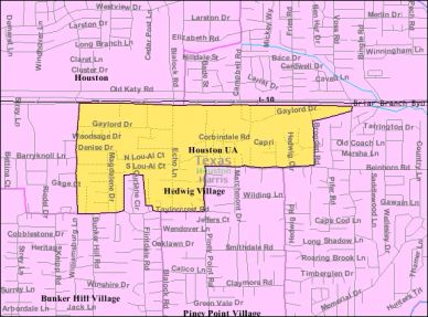
Hedwig Village is another affluent part of Spring Branch that got its start around the same time of the other villages, in 1958 becoming a city within Houston. It is located south of I-10 along with Bunker Hill & Piney Point Villages to the south of Hedwig Village.
Hunters Creek Village
Hunters Creek Village
Hunters Creek Village
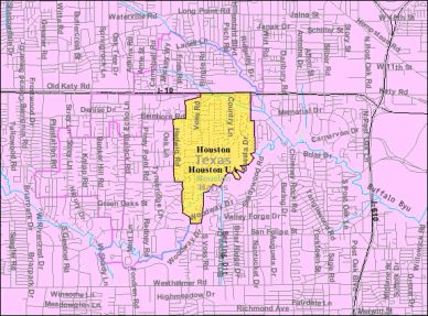
City of Hunters Creek Village, incorporated in 1954, the city of Hunters Creek Village is a vibrant community of 4,400 people living in approximately 1,460 homes. Within its 2 square miles are 22 miles of streets and 6.33 miles of hiking and biking paths. City Hall is open Monday through Friday from 8:30 am to 4:00 pm. Whether you are a resident of Hunter’s Creek or a visitor, we invite you to browse through this web site. We have included the answers to most questions you may have about our city.
Piney Point Village
Hunters Creek Village
Hunters Creek Village
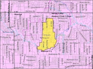
Piney Point Village is located west of Downtown Houston along Memorial Drive and near major transportation corridors including Interstate 10 and Beltway 8. The City provides convenient access to Houston’s Energy Corridor, Uptown/Galleria area, and major employment centers while maintaining a quiet residential setting.
Bunker Hill Village
Citi Centre aka Town & Country
Bunker Hill Village
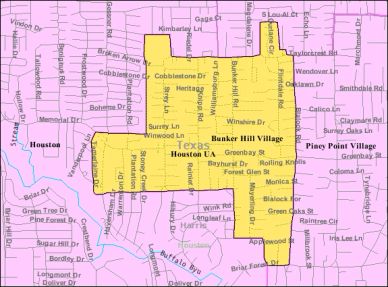
Bunker Hill is an upscale residential community located in West Houston. The city is part of the Memorial Villages. Since Bunker Hill's incorporation in 1954, the population has steadily grown from 2,000 residents to 4,000 as of 2017.
Memorial City Mall
Citi Centre aka Town & Country
Bunker Hill Village
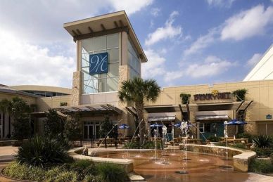
Memorial City Mall is one of Houston’s oldest malls, opening its doors in 1964. It’s first store was Sears. It had at one time some of the largest retailers in the country with Montgomery Wards, Sears, Foley’s now Macey’s, JcPenny’s and a movie theatre, which over the decades has moved locations around the mall. Today, it still has JcPenny’s and Macey, and the movie theatre, along with staples like James Avery, American Cookie Company, Auntie Anne’s, and surrounded by great restaurants likes, Ciro’s, Perry’s, Cheesecake Factory, and California Kitchen. Check out their website to learn more.
Citi Centre aka Town & Country
Citi Centre aka Town & Country
Citi Centre aka Town & Country
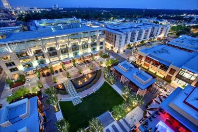
Citi Centre formerly known as Town & Country Mall which was originally opened in 1983, and the mall itself demolished in 2004, the area has been a facelift, with open-air and mixed use development. On the weekends there is often live music and entertainment for all to enjoy all with plenty of shopping spots and great restaurants. Check out their website to learn more.
Energy Corridor
Energy Corridor
Citi Centre aka Town & Country
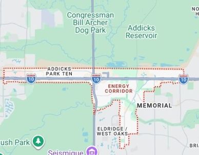
The Energy Corridor got its name because of all the oil companies that decided to move their headquarters to the far west part of Spring Branch. Energy Corridor is home to BP America, Citgo, Conoco Phillips, Copper Tip Energy, Nouryon and Shell USA, along with non-energy companies like, Gulf States Toyota and Sysco, making it a desirable places for citizens to take advantage of great neighborhoods within the area as well as a couple of urban parks, including George Bush Park and Bear Creek Pioneers Park. The parks are a part of the Barker Reservoir and Addicks Reservoir, and are a part of the flood system for Buffalo Bayou. Check out their website to see what it has to offer.
SOUTHWEST HOUSTON
Bellaire
Meyerland
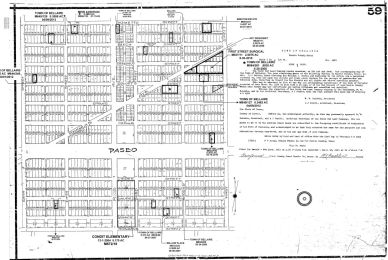
Bellaire was founded in 1908 by William Wright Baldwin. A great place to raise a family since it was primarily a residential development. Bellaire is another old city within Houston's boundaries.
Meyerland
Meyerland
Meyerland is located on the southwest side of Houston being south of the 610 Loop. Meyerland was named after the Meyer family that owned and developed the land in 1955. The majority of land of where these manicured subdivisions sit south of Bellaire, and minutes from the Galleria, Medical Center and Downtown.
Westbury
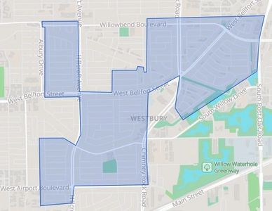
Westbury is located in Bray Oaks District and a little south of Meyerland. Westbury was developed in the 1950's and one of the largest communities in Houston with over 5000 homes. It was known as one of the hottest areas in Houston in 2007. It is a quiet neighborhood with great lawns and many of the original homes that have been updated and remodeled to the taste of the 21st century.
Braeburn Valley
Braeburn Valley
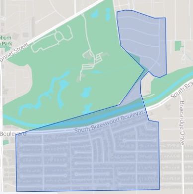
Braeburn or Braeburn Valley runs along Brays Bayou west of Hillcroft. Developed as middle class subdivisions after World War II. In the 1970’s development continued to the surrounded area which included the Braeburn Country Club as the center of the community. Other subdivisions in the area include Robindell, Braeburn Glen, Braes Terrace, Larkwood, Braeburn Valley, and the acreage lot subdivision, Brae Acres.
Sharpstown
Braeburn Valley
Sharpstown
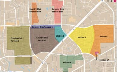
Sharpstown was the first master planned community to be developed in the City of Houston, in 1955. Sharpstown is named after the developer Frank Sharp. Frank was a man ahead of his time by making provisions for schools, shopping and recreation areas. Making his development more desirable for people looking for a neighborhood that had everything a family needing within a few minutes drive. Sharpstown is minutes from downtown, and the Medical District due to the fact that Mr. Sharp donated a 300 foot strip of land that today is a part of Interstate 59/69. The majority of the Sharpstown area of town is Deed Restricted.
Chinatown
Braeburn Valley
Sharpstown
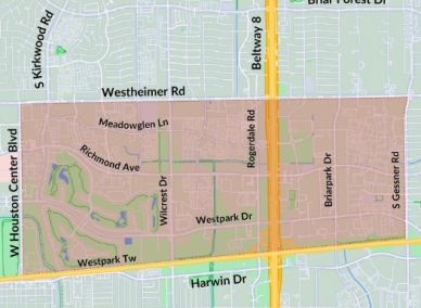
Houston's Chinatown part of the city has only been around since established in 1983. It was first on the east side of downtown, later expanding over into the southwest part of Houston. You can still find restaurants like Kim Son, but today the majority of the Chinatown District is located from Hillcroft to Bellaire and from the Southwest Freeway to the Beltway. Here you can find Chinese, Indian, Pakistani, and Middle Eastern markets, and restaurants. Explore shopping in the variety of stores along Harwin Drive, and in the Hong Kong City Market. Check out the link below for things to do in the Chinatown District.
Alief
Alief
Alief
Alief is one of Houston's most diverse communities serving a variety of ethnic groups and diverse community. Alief began its growth in the 1970's and 1980's filled with working class families that left urban parts of Houston in search of better schools and environment for family life. Alief is a part of Houston that has within it's boundaries it's own school district. The area has been on an upward movement since the turn of the century with charter schools and more job opportunities with Houston's growth in population.
WEST HOUSTON

NORTH HOUSTON
Settegast
Settegast was first developed in 1892 by German immigrants William J. and Julius J. Settegast, who had become interested in land speculation back in 1872. Settegast was further developed as a planned community in the 1940s, and had streets and lots that were platted during the same decade
Independence Heights

Independence Heights was established in 1905, and is an area just north of the 610 Loop up to 40th Street, between Yale Street and Airline Drive. This part of Houston has gone through a transformation over the last few years. Many of the old homes have been torn down and replaced with traditional homes, as well as many inexpensive luxury town-homes. The proximity to downtown and the Heights make it a place for many young professionals to purchase property with ability to stay close to bars and restaurants.
Aldine
Acres Homes
Aldine is located on the north side of Houston in parts of the ETJ, and near George Bush International Airport. The area gets its name from a local farm back in the late 19th century.
Spring
Spring is a great section of Houston on the north side which includes Old Town Spring. Old Town Spring is a fun place for shopping and walking while looking to collect those nick knacks around the house or for a gift. Visit Mercer Botanic Gardens which is always a nice walk.
Bush International Airport

George Bush Intercontinental Airport is a top notch airport built in 1969, originally named Houston Intercontinental Airport. Renamed in 1997, it is the second busiest airport in Texas. Tips in travel. Make sure to schedule parking. Join Clear to get through TSA quickly. It cost a little, but worth it. Enjoy your trip.
Southeast Houston
Baytown
Galena Park
Galena Park
Baytown is actually a combination of 3 towns that merged in 1947 when finally consolidating. Baytown is in Harris and Chambers Counties, on the Galveston bay. Baytown is one of the many towns or cities built on oil as Exxon remains to be one of their largest employers. Learn more about this city of the south end of Houston. Click to learn more about Baytown.
Galena Park
Galena Park
Galena Park
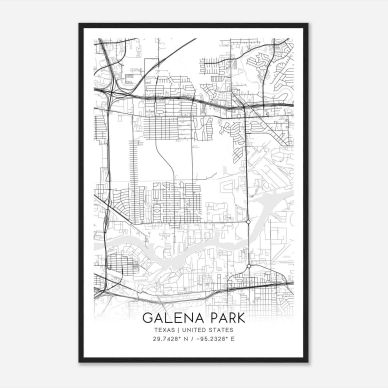
Galena Park is on the east side of town and named after the first refining company (Galena Signal Oil Company) that was located in the area in 1935. Between the 1940-1980’s the area around grew as the City of Houston grew. Galena Park is yet another town within the city limits of Houston. This quite town is predominantly a blue collar with most people working at oil refining companies in the vicinity or at the near by Port of Houston. Visit the Galena Park website to learn more.
Pasadena
Galena Park
Deer Park
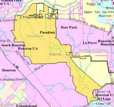
Pasadena, founded in 1893. Pasadena is the 2nd largest city in Harris County on the southeast side of Houston. The oil boom between 1917-1920 saw an expansion of growth for Pasadena as it became a part of oil and gas industry. Learn more about Pasadena by click the link below.
Deer Park
Deer Park
Deer Park since it was founded in 1892 by Simeon H. West, had it's up and really low downs having a population of 40 people in 1922. And here again the oil industry rescues a small town outside of Houston when Shell Oil breaks ground on a new refinery in 1928. Twenty years later the citizens incorporated Deer Park's territory. Visit their website to learn more.
Jacinto City
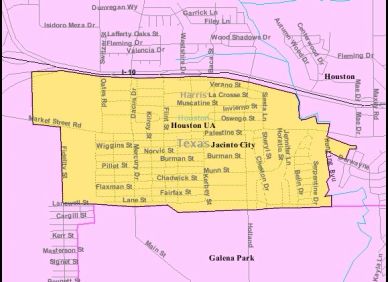
Jacinto Park is just north of Galena Park and another small town within the Houston city limits. Jacinto Park was established in 1941, by Frank Sharp as a subdivision for shipyard and steel mill workers. The subdivision was incorporated in 1947. The area shares school districts with Galena Park ISD. Check out the Jacinto City website to learn more.
Cloverleaf

Cloverleaf is another older part of Houston, situated between Jacinto City and Channelview. This part of town is mostly residential with of course some industrial with it's proximity to railyard. The homes in Cloverleaf were built in the mid-20th century. The majority of homes are midcentury ranch and/or brick bungalows. The neighborhoods are filled with small – yet equally sized lots. Homes sell between $230,000 and $270,000, while newer or renovated homes can sell between $280,000 and $310,000.
Channelview
Channelview
Channelview
Channelview is located on the northeastern curve of the ship channel, hence the name. Located in Harris County, with it's own school district, and home of Super Bowl quarter back Jalen Hurts. Check out the Channelview website for more.
NORTHEAST HOUSTON




KATY

Southeast Houston
Baytown
Galena Park
Galena Park
Baytown is actually a combination of 3 towns that merged in 1947 when finally consolidating. Baytown is in Harris and Chambers Counties, on the Galveston bay. Baytown is one of the many towns or cities built on oil as Exxon remains to be one of their largest employers. Learn more about this city of the south end of Houston. Click to learn more about Baytown.
Galena Park
Galena Park
Galena Park
Galena Park is on the east side of town and named after the first refining company (Galena Signal Oil Company) that was located in the area in 1935. Between the 1940-1980’s the area around grew as the City of Houston grew. Galena Park is yet another town within the city limits of Houston. This quite town is predominantly a blue collar with most people working at oil refining companies in the vicinity or at the near by Port of Houston. Visit the Galena Park website to learn more.
Pasadena
Galena Park
Deer Park
Pasadena, founded in 1893. Pasadena is the 2nd largest city in Harris County on the southeast side of Houston. The oil boom between 1917-1920 saw an expansion of growth for Pasadena as it became a part of oil and gas industry. Learn more about Pasadena by click the link below.
Deer Park
Deer Park
Deer Park since it was founded in 1892 by Simeon H. West, had it's up and really low downs having a population of 40 people in 1922. And here again the oil industry rescues a small town outside of Houston when Shell Oil breaks ground on a new refinery in 1928. Twenty years later the citizens incorporated Deer Park's territory. Visit their website to learn more.
Jacinto City
Jacinto Park is just north of Galena Park and another small town within the Houston city limits. Jacinto Park was established in 1941, by Frank Sharp as a subdivision for shipyard and steel mill workers. The subdivision was incorporated in 1947. The area shares school districts with Galena Park ISD. Check out the Jacinto City website to learn more.
Cloverleaf
Cloverleaf is another older part of Houston, situated between Jacinto City and Channelview. This part of town is mostly residential with of course some industrial with it's proximity to railyard. The homes in Cloverleaf were built in the mid-20th century. The majority of homes are midcentury ranch and/or brick bungalows. The neighborhoods are filled with small – yet equally sized lots. Homes sell between $230,000 and $270,000, while newer or renovated homes can sell between $280,000 and $310,000.
Channelview
Channelview
Channelview
Channelview is located on the northeastern curve of the ship channel, hence the name. Located in Harris County, with it's own school district, and home of Super Bowl quarter back Jalen Hurts. Check out the Channelview website for more.